West 6th Avenue Speed Reduction Striping
ARCHIVED
Due to negative community feedback, striping changes to West 6th Avenue between Kohl Street and US 287 will not be made, and parking will not be removed at this time. Striping will be implemented on West 6th Avenue between Kohl Street to Daphne Street without parking removal later this spring. Read the full outcome under the “Project Updates” tab.
The City and County of Broomfield (CCOB) considered striping West 6th Avenue to include bike lanes and narrow lanes to reduce vehicle speeds. The latest project updates can be found under the “Project Updates” tab below.
Project Summary
The City and County of Broomfield (CCOB) considered a traffic mitigation and striping project along West 6th Avenue between Highway US 287 and Daphne Street.
The project sought to address neighborhood concerns regarding vehicular speeding by implementing striping changes that would visually narrow vehicle lanes and add bike lanes as identified in the 2019 Bicycle and Pedestrian Assessment. Restriping streets is a low-cost form of traffic calming that can help slow speeds. Anticipated construction impact would have been minimal and no road closures were expected.
Speed Reduction Interventions
Over the past 20 years, various speed control measures have been attempted on West 6th Avenue, including entry islands, striped parking areas, speed radar signs, and, most recently, flex posts. However, speeding issues still persist, as voiced by concerned neighborhood residents and evidenced in collected traffic data. This striping project would implement another speed reduction tool, while also providing a multimodal benefit.
West 6th Avenue: US 287 to Kohl Street
As part of the project evaluation, CCOB completed a parking study indicating that parking within the public right of way is not highly utilized in the section of West 6th Avenue between US 287 and Kohl Street (under 20%).
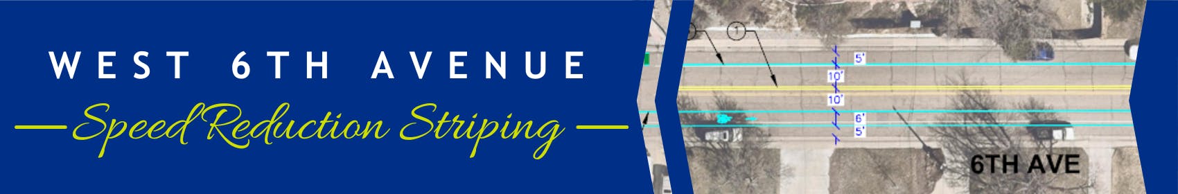
To accommodate all modes of transportation and address neighborhood speeding concerns, parking on the north side of 6th Avenue between US 287 and Kohl Street was proposed to be removed, and a bike lane installed. Parking would remain on the south side of West 6th Avenue in this section, with a new bike lane installed. An image from the cross-section showing the proposed striping is below.
View the full set of striping plans from US 287 to Kohl Street.

West 6th Avenue: Kohl Street to Daphne Street
On West 6th Avenue from Kohl Street to Daphne Street, parking would remain on both sides of the roadway because driveways are distributed equally on both sides of West 6th Avenue, with parking utilization closer to 50%.
With this configuration, a bike lane would be installed uphill in the eastbound direction. Downhill, in the westbound direction, shared roadway markings would be planned, indicating the safest place to ride for bicyclists.
View the full striping plans from Kohl Street to Daphne Street.
Public Engagement Summary
In early 2025, 265 community members completed a three-question pulse survey to share their sentiment and comments about the proposed speed reduction striping. Responses were received from residents who live on 6th Avenue between US 287 and Kohl Street, residents who frequently travel down 6th Avenue and community members who don’t regularly use the street. Due to general negative feedback from all three groups, striping changes will not be implemented on West 6th Avenue between Kohl Street and US 287 at this time. Striping without parking removal will be added to West 6th Avenue between Kohl Street and Daphne Street. You can find more information about community feedback under the “Project Updates” tab.
ARCHIVED
Due to negative community feedback, striping changes to West 6th Avenue between Kohl Street and US 287 will not be made, and parking will not be removed at this time. Striping will be implemented on West 6th Avenue between Kohl Street to Daphne Street without parking removal later this spring. Read the full outcome under the “Project Updates” tab.